


Cedar Township Voting District, Wilson County, Kansas
About
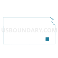
Outline

Summary
| Unique Area Identifier | 587635 |
| Name | Cedar Township Voting District |
| County | Wilson County |
| State | Kansas |
| Area (square miles) | 36.08 |
| Land Area (square miles) | 35.73 |
| Water Area (square miles) | 0.35 |
| % of Land Area | 99.03 |
| % of Water Area | 0.97 |
| Latitude of the Internal Point | 37.51598520 |
| Longtitude of the Internal Point | -95.68314810 |
Maps


Graphs
Select a template below for downloading or customizing gragh for Cedar Township Voting District, Wilson County, Kansas


Neighbors
Neighoring Voting District (by Name) Neighboring Voting District on the Map
- Center Township Voting District, Wilson County, KS
- Chetopa Township Voting District, Wilson County, KS
- Guilford Township Voting District, Wilson County, KS
- Neodesha Township Voting District, Wilson County, KS
- Pleasant Valley Township Voting District, Wilson County, KS
- Talleyrand Township Voting District, Wilson County, KS
Top 10 Neighboring County Subdivision (by Population) Neighboring County Subdivision on the Map
- Cedar township, Wilson County, KS (613)
- Neodesha township, Wilson County, KS (563)
- Center township, Wilson County, KS (505)
- Talleyrand township, Wilson County, KS (227)
- Pleasant Valley township, Wilson County, KS (219)
- Guilford township, Wilson County, KS (168)
- Chetopa township, Wilson County, KS (162)
Top 10 Neighboring Place (by Population) Neighboring Place on the Map
Top 10 Neighboring Unified School District (by Population) Neighboring Unified School District on the Map
- Fredonia Unified School District 484, KS (4,713)
- Neodesha Unified School District 461, KS (3,573)
- Altoona-Midway Unified School District 387, KS (1,663)
Top 10 Neighboring State Legislative District Lower Chamber (by Population) Neighboring State Legislative District Lower Chamber on the Map
Top 10 Neighboring State Legislative District Upper Chamber (by Population) Neighboring State Legislative District Upper Chamber on the Map
Top 10 Neighboring 111th Congressional District (by Population) Neighboring 111th Congressional District on the Map
Top 10 Neighboring Census Tract (by Population) Neighboring Census Tract on the Map
- Census Tract 974, Wilson County, KS (3,037)
- Census Tract 971, Wilson County, KS (2,084)
- Census Tract 972, Wilson County, KS (1,525)